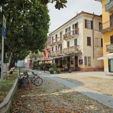
The drive from Sedona to the Grand Canyon wasn't bad. It was just about 2 hours. Unlike the East Coast, there was zero traffic. Just open roads and open desert all the way there. There were a few winding roads as we had to go over the Red Rock canyons, but besides that flat and deserted. We were based in Sedona, but had to take a mandatory day trip to what some consider one of the wonders of the world: The Grand Canyon. Fascination with the Grand Canyon spans all ages and all countries. The depiction of that deep and endless earth-shattering chasm has made it around the whole globe. And while talks have described the experience, and Ooh Aah Point on Kaibab Trail lives up to it's name, no article, no picture, or no video can do it justice. That's why you should pick up your keys and drive there yourself, don't just settle for reading this article.
Park Pass, Area, and Size
We pay our $35 vehicle national park pass (that lasts up to 7 days) and enter the second most visited national park in the United States. The Grand Canyon sees about 5.9 million visitors per year, so making sure you get there early in the morning will help you avoid the riff raff. We spent the day on the South Rim, which is the rim closest to Sedona. While it may seem like North Rim is only "10 miles away," you have to drive around the Grand Canyon which can take up to 5 hours. So stick to just the South Rim if you're taking a day trip from Sedona to the Grand Canyon.
A day trip will just give you a taste, but you'll need much longer if you plan on seeing it all. For context, the Grand Canyon is bigger than the state of Rhode Island, it's 1,900 sq ft vs Rhode Island's 1,200 sq ft. It's about 277 miles long and 18 miles deep.
As you stand on the edge of the canyon, you find yourself staring out across at millions of years of abyss. What you're staring at is 6 million years of the earth's layers. Geological activity and erosion from the Colorado River is what created the Grand Canyon allowing us to literally be looking back at history. As I stand there, I start to wonder how it's possible that the earth hasn't started crumbling below my feet as we speak.
How to See the South Rim
There are many ways to see the South Rim. You can travel on foot, on horseback, cling to a mule (I kid you not...see more on that below), fly over it in a helicopter or ride the Colorado Rivers rapids. You can see it from air, land, or sea. However you wish. Our method of choice is physical activity, so a hike it is. As we walk the South Rim and take in the grandiosity of the Grand Canyon, we make our way towards our hike for the day: Kaibab Trail.
Kaibab Trail
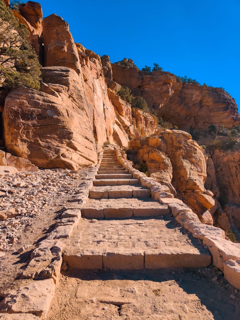
The beauty of this trail is you can make it as long as you like. We went all the way to Cedar Ridge with a stop at Ooh Ahh Point. A 3-mile, out and back, 2,500 foot elevation switchback trail that takes you down to Cedar Ridge. It takes anywhere from 2-4 hours to complete. However, if you're looking for something more or less aggressive, here are the stops along the way:
How to Get to Kaibab Trail
To get there, you park at Lot 1 & 2, walk to the shuttle bus pick-up, and take the Kaibab Rim (Orange) Bus route. The bus doesn't come very frequently so try and time it correctly. If you're lucky like us, you will find street parking just a 15-minute walk from the Kaibab trail.
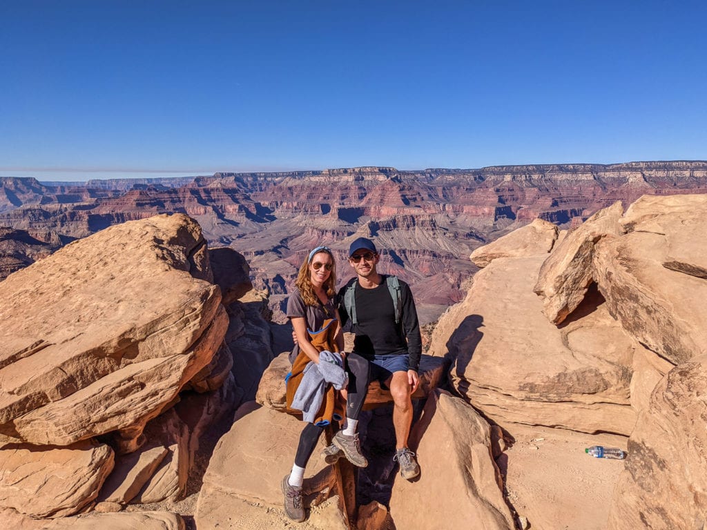
The Hike to Cedar Ridge via Ooh Aah Point
As we near the entrance, we begin to feel the strong winds from the canyon pushing up towards our faces and sweeping our hair back. We suddenly become very aware of the power in that chasm. Because the Grand Canyon is so deep, it can create it's own micro-climate, making it very difficult to hike. We started off cold at 8,000 feet, but as we descended the canyon and got to 6,000 feet, we were stripping off layers. In the canyon, the temperature increases by 5.5 degrees Fahrenheit with each 1,000 feet loss in elevation. I recommend you come prepared with a backpack and layers that are light, but warm.
My favorite hiking and skiing backpacks are non-bulky and conform to your back. The type that fit just the right amount of stuff without weighing you down. When it comes to layers, I always pack my tiny packable and portable down jacket for when I get super cold.
Pat and I were cautious to pace ourselves after reading online about the strenuousness and difficulty hiking the Grand Canyon. While going down feels easy, people always underestimate the elevation change and difficult of hiking back UP the Canyon. We stopped at the recommended stopping point for most, Cedar Ridge. However, the all-day trek proved to be much easier than advertised. Either that, or Patrick and I are in ridiculously good shape because we did it in under 2 hours.
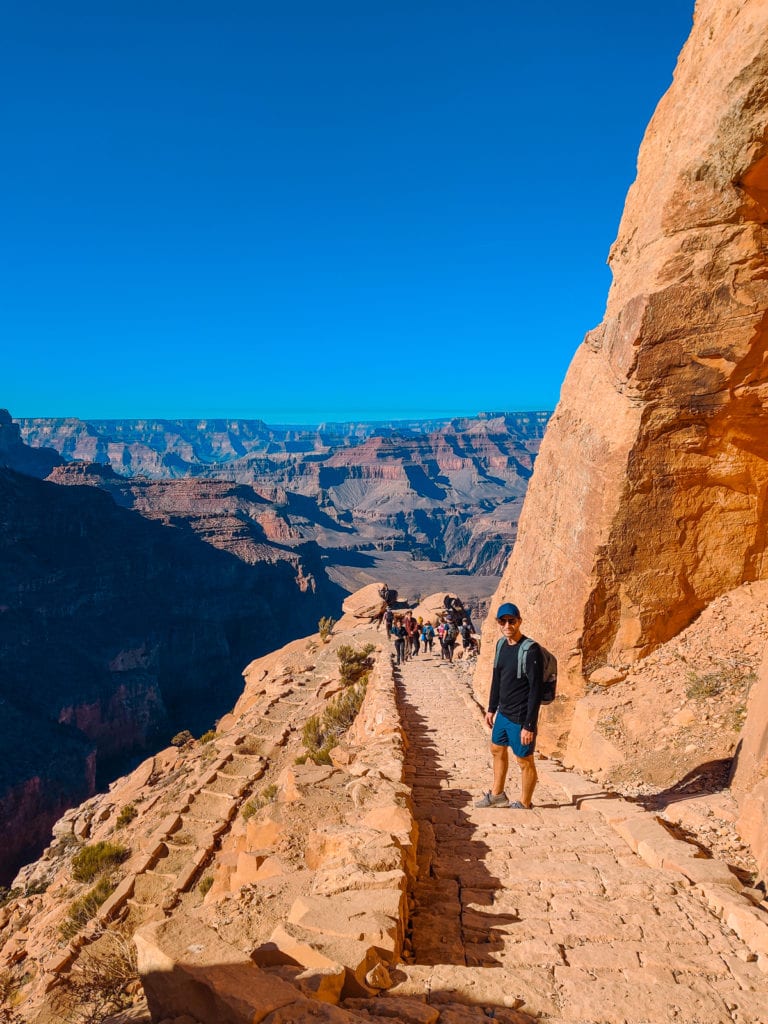
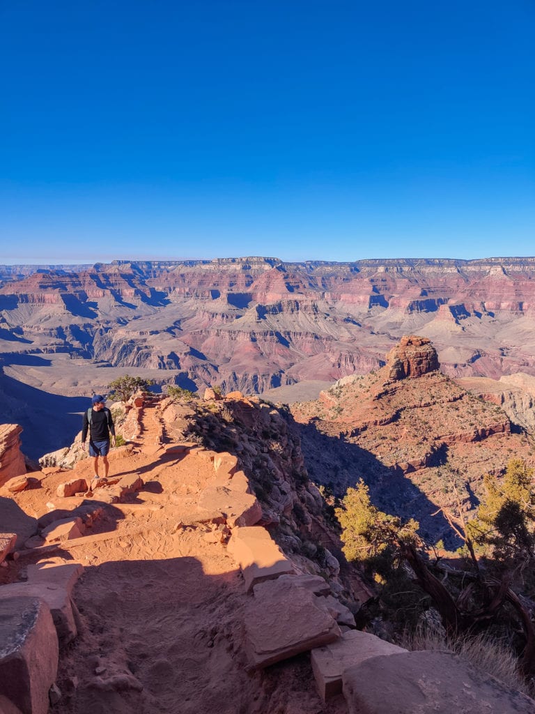
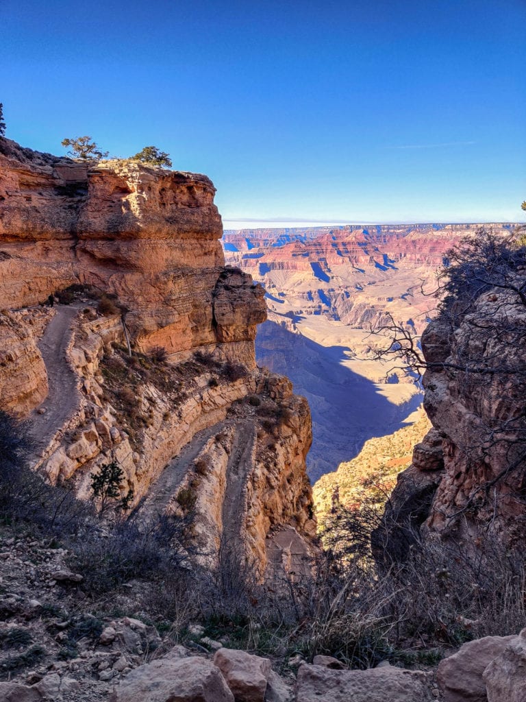
The hike was steep, but gentler than we had imagined. I was definitely happy we were wearing our Salewa ankle hiking boots for stability because the tiny pebbles definitely made me feel a bit unstable at times. Especially because the trails was narrow, and being afraid of heights, I was happy to have shoes that made me feel like I'd stay on track. While hiking down the Grand Canyon's grandiose splendor, we examined the scenery up close and admired the hidden perspectives unseen from rim-side overlooks. What hiking allows you to do is participate in nature and witness places that are otherwise unreachable.
While your hiking, take a deep breath. The elevation of the South Rim is around 7,000 feet (2133m) above sea level and due to it's well-maintained conservation, the Grand Canyon actually has some of the cleanest air in all of the US. So breathe, breathe, breathe it in!
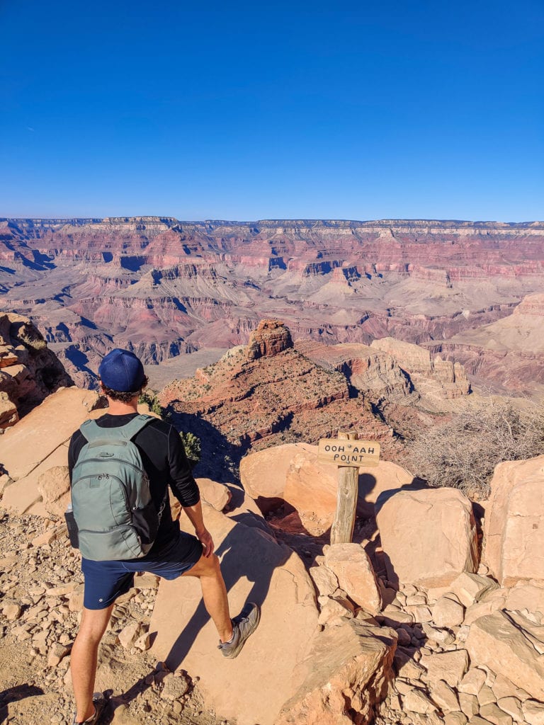
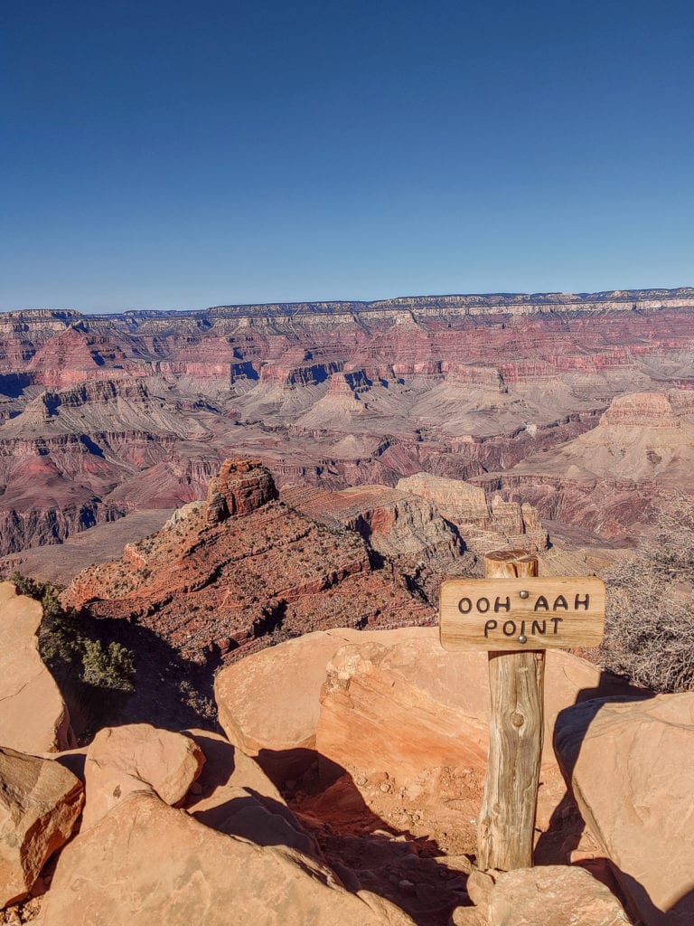
The first popular turn around spot is Ooh Aah Point. When you get closer to it, you will be thinking to yourself...gosh, my life be like Ooh Aah. The views are beautiful and quite dramatic. This is where most people call it quits and hike back up.

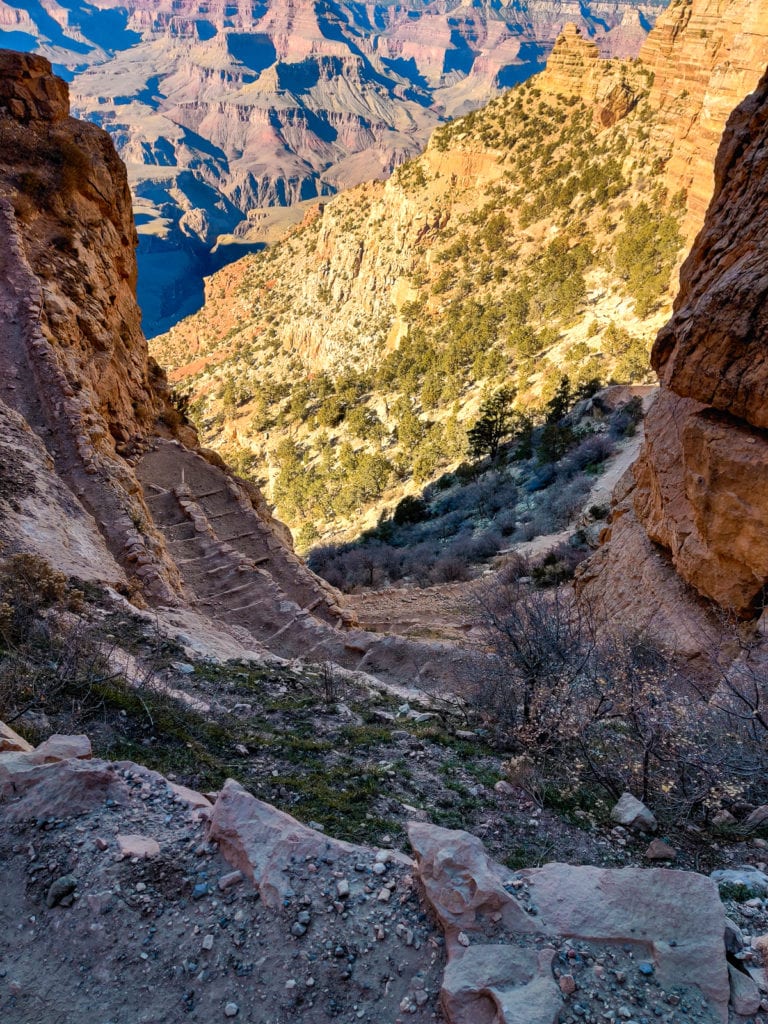
At this point, Patrick and I had gotten to Ooh Aah Point so quickly, we couldn't turn around just yet. So we decided to continue to Cedar Ridge. Cedar Ridge is the recommended stopping point for most people and always during the summer months because it is too hot to continue. This spot felt like a deserted plain in the middle of the canyon. This is the point of the hike where you stop and use the restroom facilities on the plain. Pat and I ate some snack bars, took in the view, and thought about whether to continue. We had already descended 2,400 ft...and while the hike may feel easy down, elevation is what gets you on the way back up. We decided to turn around at this point.
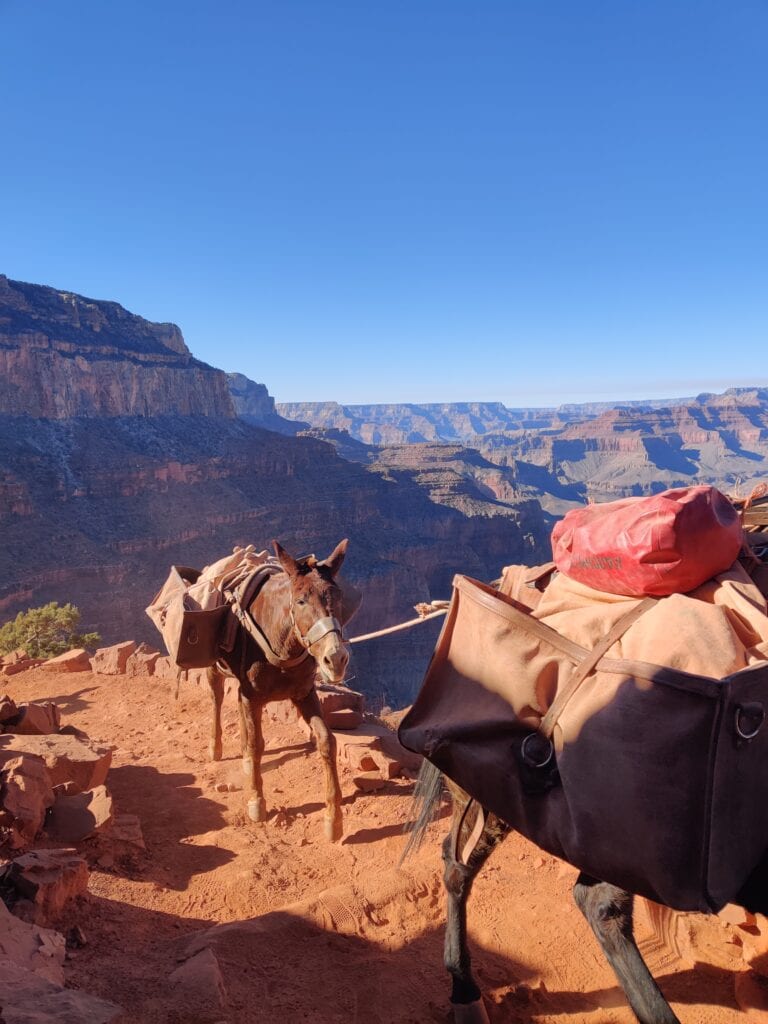
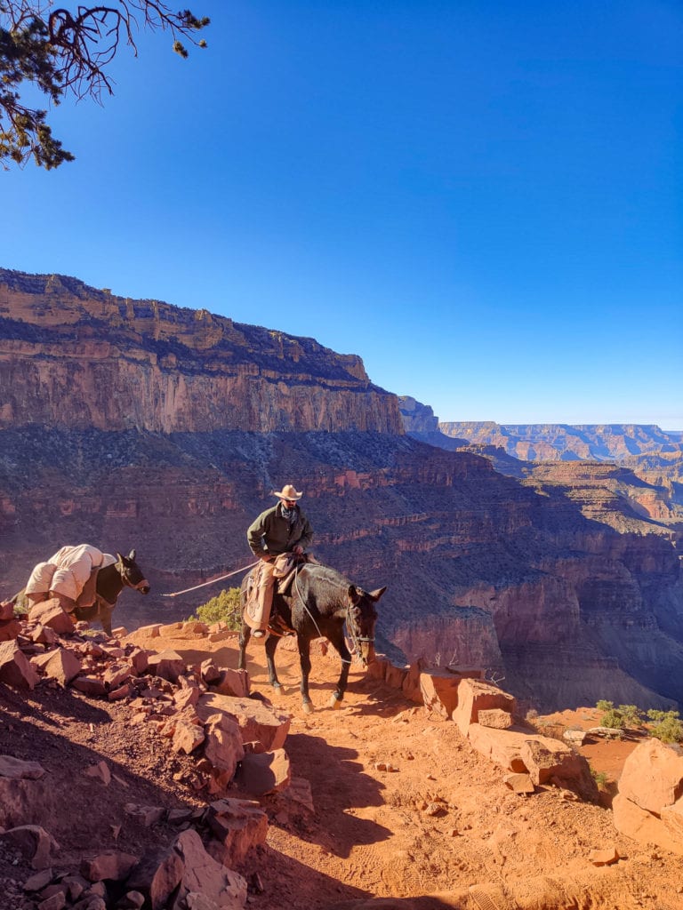
If you decide to go to bottom of the canyon, many stay at the Havasupai Indian Reservation. The Kaibab trail is the fastest trail to get to the river at the bottom of the Grand Canyon. People are always surprised when they hear this, but there are 4 Indian tribes that live in the actual Grand Canyon: The Hopi, Navajo, Paiute and Hualapai. The Supai Village has a population of 208. There mail is delivered by pack mule, due to it being inaccessible by road, and you will encounter the pack mules on your way up and down the Grand Canyon. When you do, step to the side of the canyon and let them pass. Like I said the trail is very narrow so it's quite scary to see the mules walk on the edge of the trail and not see them fall or the trail crumble. Even scarier are the people riding the mules, they must have no fear!
At the end of our not so hard hike, yet exhilarating day, I peered back into the Canyon and retraced our steps with my eyes. I felt an overwhelming sense of joy, pride, and wonder.
>> Next: My Experience Hiking Cathedral Rock Trail Vortex in Sedona